Earlier we posted a short article about using annual rainfall to identify deserts. Now we will use rainfall to identify rain forests. In this case a rain forest is defined as locations where rainfall is greater than 2000mm a year. Temperatures are also important but for now we are just interested in defining rainforests based on rainfall. We pulled together global monthly rainfall to create a map of total annual rainfall and extracted areas where total annual rainfall was greater than 2000mm.
Spatial distribution of rain forests (total annual rainfall > 2000mm), 2020
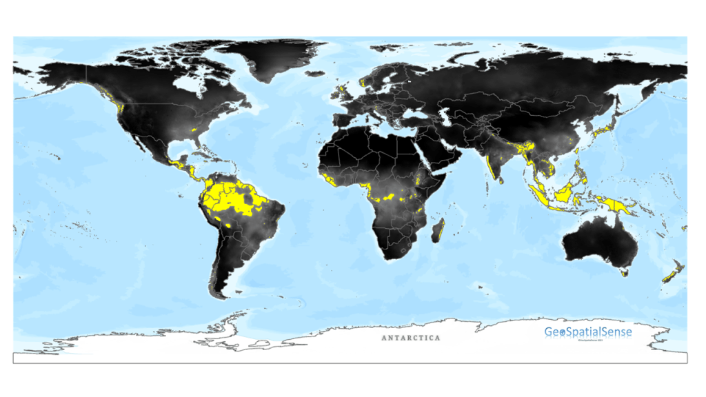
Note that the map was created using rainfall data for 2020 and as such the spatial distribution of rain forests will change from year to year with changes in total rainfall. More work is needed to examine stable rain forest locations but that is for another time.
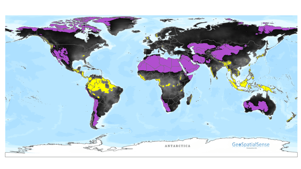
By integrating the desert (areas in purple) with the rain forest (yellow) areas we can see how these two different biomes are distributed.
© 2023-present GeoSpatialSense. All Rights Reserved
