Spatial Interpolation Methods
For those of you new to interpolation methods. Interpolation is a procedure used to predict the values at locations that lack sampled points. It is based on the principle of spatial autocorrelation or spatial dependence (e.g. Tobler’s First Law of Geography), which measures degree of relationship or dependence between near and distant objects (Childs 2004).
A number of different interpolation methods are available that can be used to capture different phenomena across space, such as temperature, rainfall, air pollution, disease prevalence, minerals and so on. To give you an overview see Table 1 where these different methods have been summarized. For more details see Table 2.
Table 1. Summary of the different interpolation methods are available (Source: (ESRI 2021); (Childs 2004)):
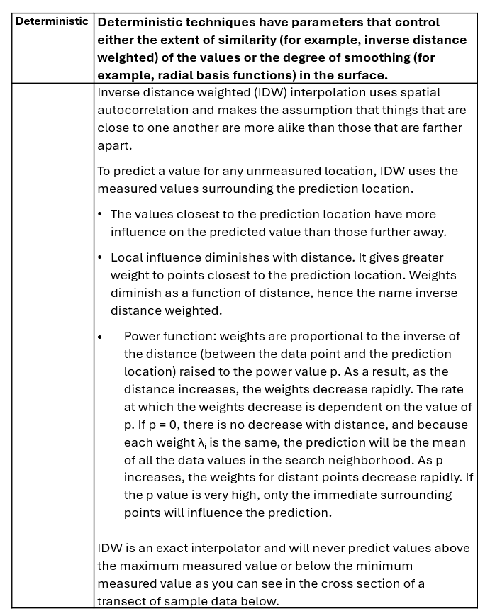
| Deterministic | Deterministic techniques use parameters that control either the extent of similarity of the values or the degree of smoothing in the surface. There are a number of different interpolators that include: Global polynomial, Local polynomial, Inverse distance weighted (IDW), Radial basis functions, Spline, Natural Neighbour |
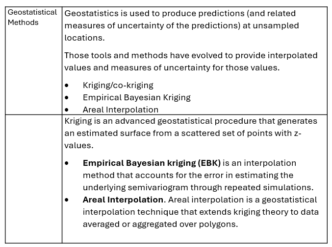
| Geostatistical Methods | Geostatistics methods are used to produce predictions and related measures of uncertainty of the prediction at unsampled locations. There are several methods available that include: Kriging/co-kriging, Empirical Bayesian Kriging, Areal Interpolation |
Table 2 Summary and brief description of some of the more commonly used interpolation methods such as Inverse Distance Weighting, Geostatistical or Kriging methods. For a quick overview see (Childs 2004) or (ESRI 2021).
For a quick intro to interpolation view this video
Sources:
- Blanford, J.I. (2025) Interpolation methods: what are they and how do they work?. YouTube.
- Childs, C. (2004) Interpolating Surfaces in ArcGIS Spatial Analyst. ArcUser, July-September, 32-35.
- ESRI (2021) Classification Trees of the interpolation methods offered in geostatistical analyst. https://pro.arcgis.com/en/pro-app/latest/help/analysis/geostatistical-analyst/classification-trees-of-the-interpolation-methods-offered-in-geostatistical-analyst.htm
© 2023-present GeoSpatialSense. All Rights Reserved
